Mapped and analyzed the spatial distribution of permitted food trucks across Austin using QGIS, revealing clustering patterns relative to population density, transit corridors, and zoning boundaries.
Built an interactive Leaflet.js web map allowing users to filter vendors by category and neighborhood, with custom marker styling and pop-up detail panels for each location.
Texas County Median Income Spatial Autocorrelation
PythonGeoPandasPySALesda
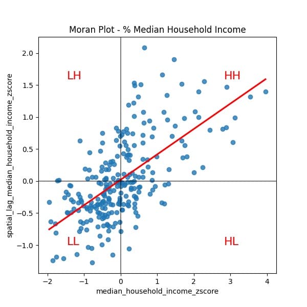
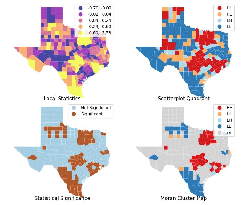
Conducted a county-level spatial autocorrelation analysis of median household income across Texas using Moran's I and Local Indicators of Spatial Association (LISA), identifying statistically significant high-income and low-income spatial clusters.
Visualized LISA cluster maps and Moran scatterplots to communicate regional income inequality patterns, highlighting persistent geographic disparities between urban cores and rural hinterlands.
Austin NAIP Building Segmentation
PyTorchU-NetDeepLabV3+SegFormer
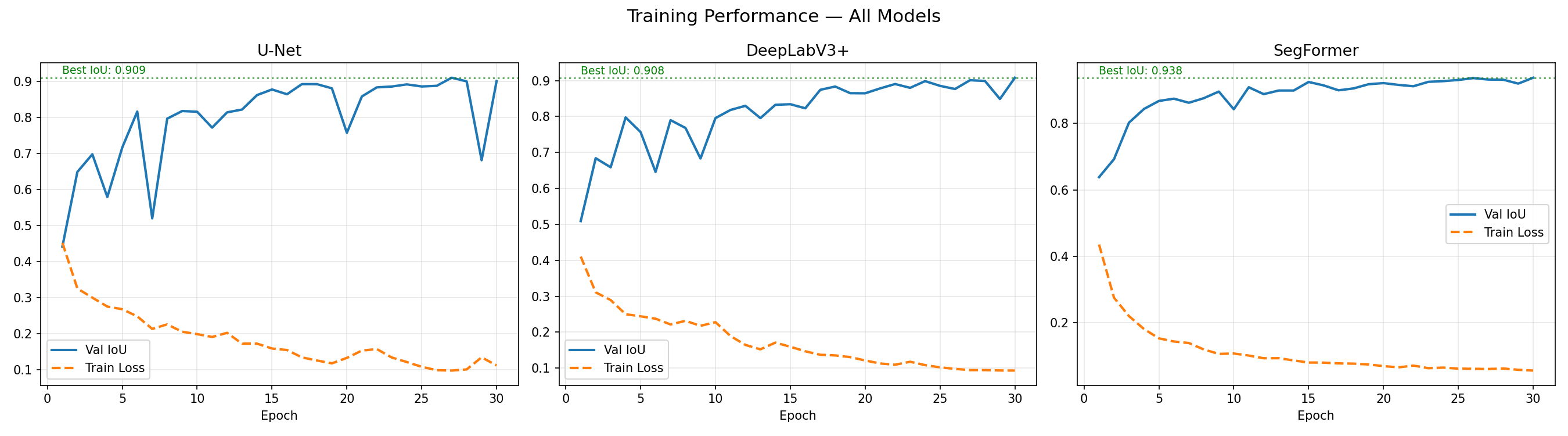
Trained and benchmarked three semantic segmentation architectures — U-Net, DeepLabV3+, and SegFormer — on high-resolution NAIP aerial imagery of Austin to extract building footprints, evaluating each model on IoU, F1, and inference speed.
SegFormer outperformed CNN-based baselines in mean IoU by ~4 pp, demonstrating that transformer-based encoders better capture long-range spatial context in overhead imagery for urban building delineation.